Bödeker Systems specialises in delivering analytical and software development solutions tailored for planning, construction, and management. We advise businesses and public institutions on how to harness information resources to enhance decision-making, optimise operational efficiency, and engage potential clients through data-driven strategies.
Management decisions require linking relevant questions to available data. Essential is the collection of data from different sources, organisation of information, and development of a fit-for-purpose method to convert the results into solutions before communicating the findings in a way that positively affects business decisions.
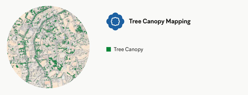
Allows progress monitoring of greening projects by locating and quantifying tree canopy and shade distribution.
Base data for tree inventory used in planning and management
We provide support in understanding and exploiting the spatial aspect of relevant data. Our hands-on technical services help you use the potential of your data. We guide our clients to better understand and locate their assets and identify relationships and associated opportunities.
Find, record and remove graffiti, raise public awareness and reduce maintenance costs.
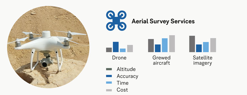
Reduce field time and survey costs, provide accurate and exhaustive data, and for less accessible areas.
Quantify maintenance and management needs, and improve performance of assets.
Management decisions require linking relevant questions to available data. Essential is the collection of data from different sources, organisation of information, and development of a fit-for-purpose method to convert the results into solutions before communicating the findings in a way that positively affects business decisions.
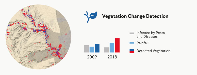
Vegetation monitoring over time allows the detection and quantification of changes in the distribution and health of plants. NDVI surveys of differences in vegetation cover over time can be an indicator of underlying changes in environmental conditions.
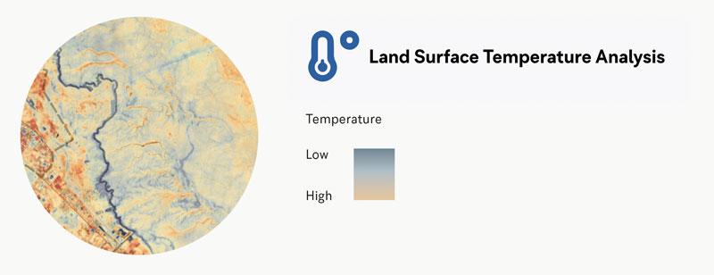
Informs urban planning decisions and material selection by providing detailed evidence of the urban heat island effect.
Find, record and protect large and significant trees, and raise public awareness of their value.
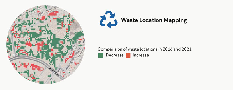
Monitor non-compliance to land use regulations and quantify land degradation
Spatial analytics help organisations exploit the power of GIS for various applications. For example, the critical applications in urban planning are land-use suitability, cost-benefit analysis of developments, change detection of natural assets and optimising resource allocation in a facility and infrastructure context.
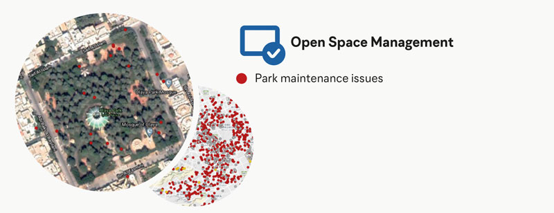
Crowd-source and manage work requests, streamline operations and engage the public.
Assess progress and changes on-site during construction and maintenance projects.
Streamlined procurement and quality improvement. Supplying the public sector through an online marketplace for the plant and nursery product supply chain increases the quality and diversity of plants on a regional level.
Manage open spaces and facilities in a transparent efficient way. Public spaces and facilities are complex and require regular interventions from technical specialists to maintain functional public or private services and facilities.
We integrate client data with various open-source resources, including Sentinel-2 as well as USGS satellite data, WHO data, and Google Open Data Explorer, to provide valuable analytical insights.
For spatial inquiries, we utilise tools such as ArcGIS, QGIS, GrassGIS, MapServer, MapBox, PostgreSQL, and DroneDeploy in conjunction with Python, JavaScript, Docker, and the R language, among others. We also partner with Fulcrum to ensure efficient site data collection. In addition, when it comes to purely statistical questions, Bödeker Systems relies on RStudio, Mathlab, Filemaker, and Tableau.
To present our findings effectively and ensure well-informed and streamlined decision-making and communication, we create interactive websites and dashboards using Shiny apps, InfluxDB, and WordPress interfaces.